
Port of Taranto — PRP / FOW / Reverlast reference map
This page presents a documentary planning reference. It is not a cadastral survey, concession map or confirmation of site availability.
Official reference sources
AdSP Taranto PRP · POT 2026–2028 PDF · Taranto Coast Guard ordinances · Puglia PPTR WebGIS
Official PRP plates
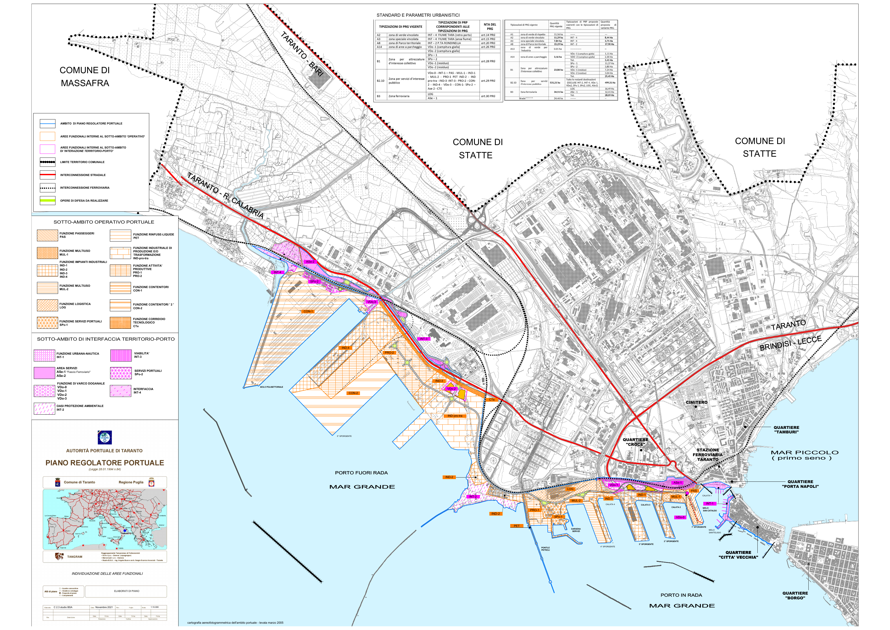
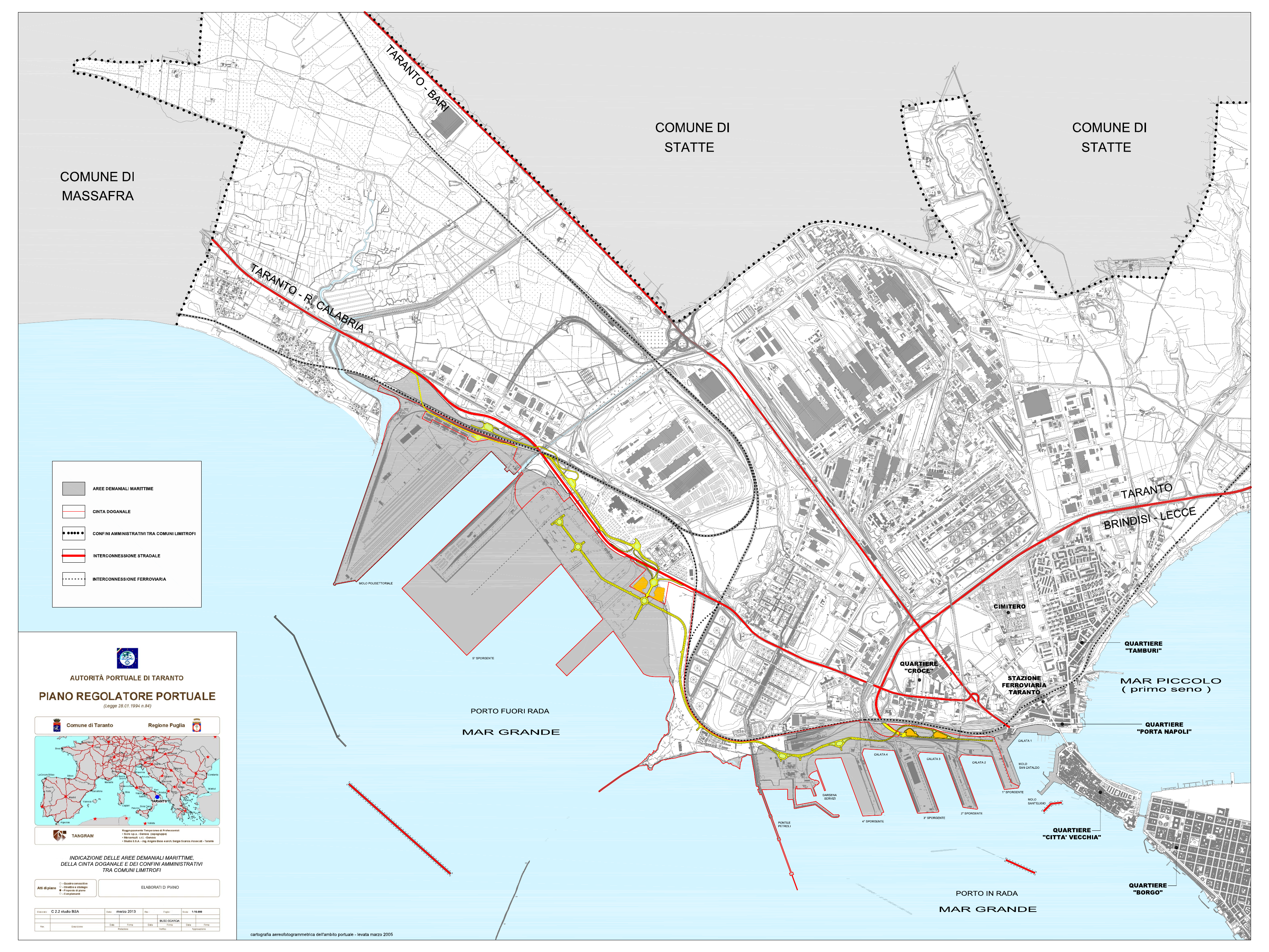
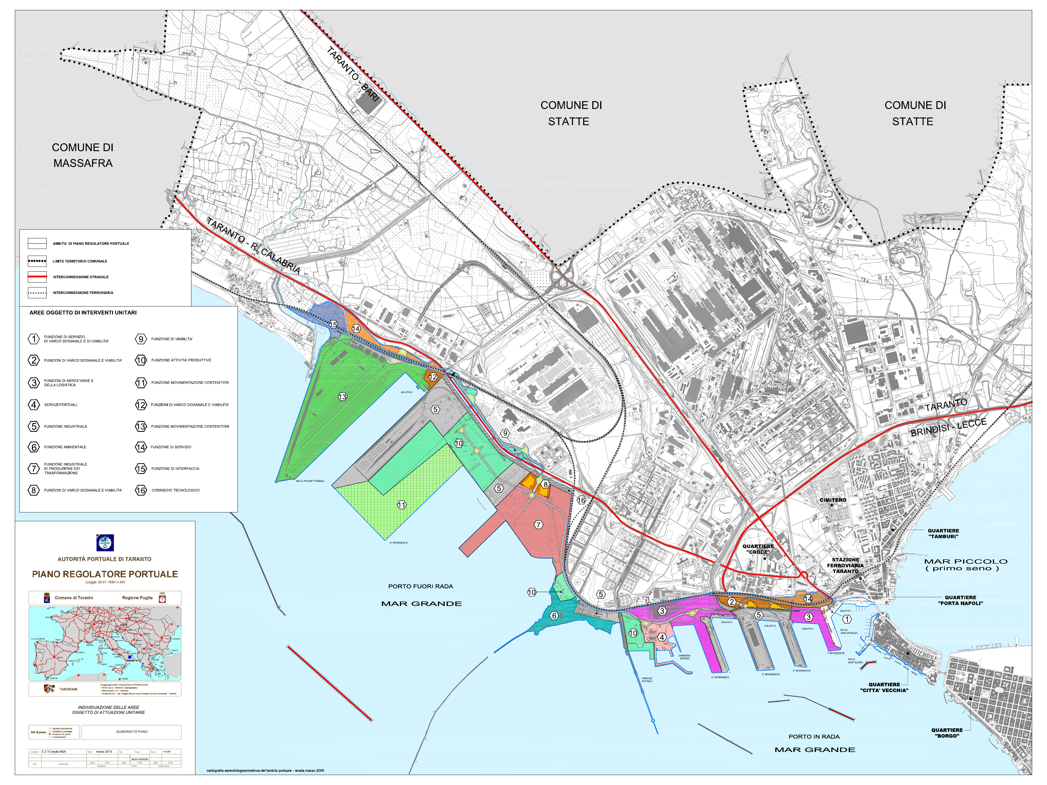
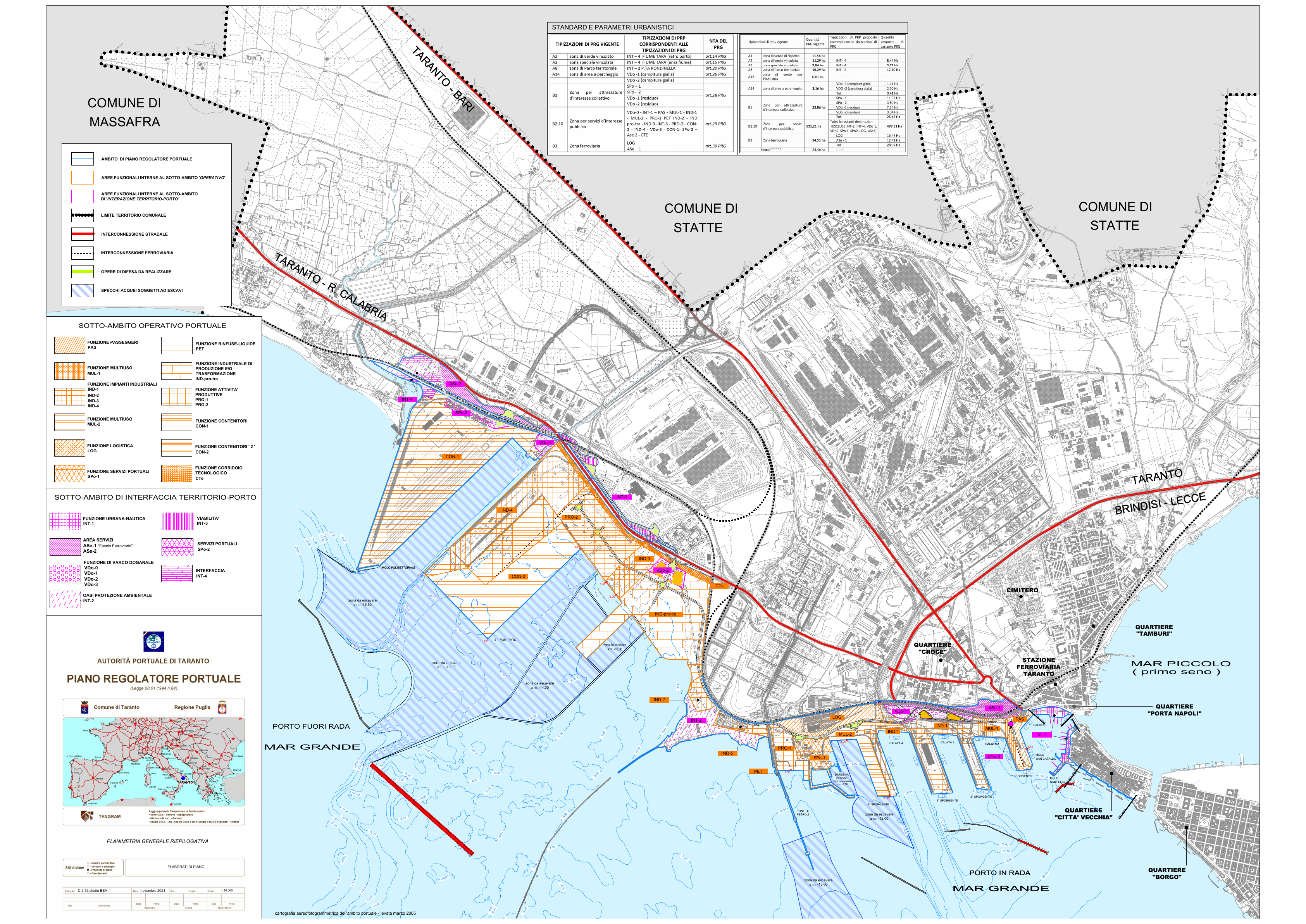
Floating offshore wind options in POT 2026–2028
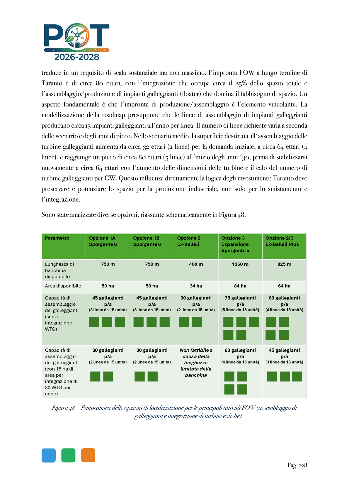
| Option | Quay | Area | Capacity | Reference classification |
|---|---|---|---|---|
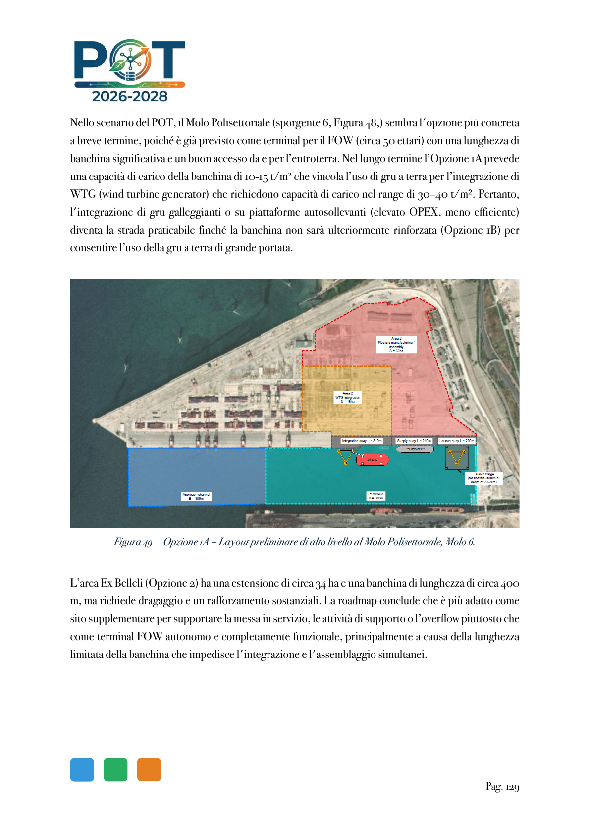
| 1A/1B Sporgente 6 | 750 m | 50 ha | 45 floaters/year; 30 with 18 ha WTG | POTENTIALLY COMPATIBLE — coordinate with CON-1, bearing capacity, works, terminal and title. |
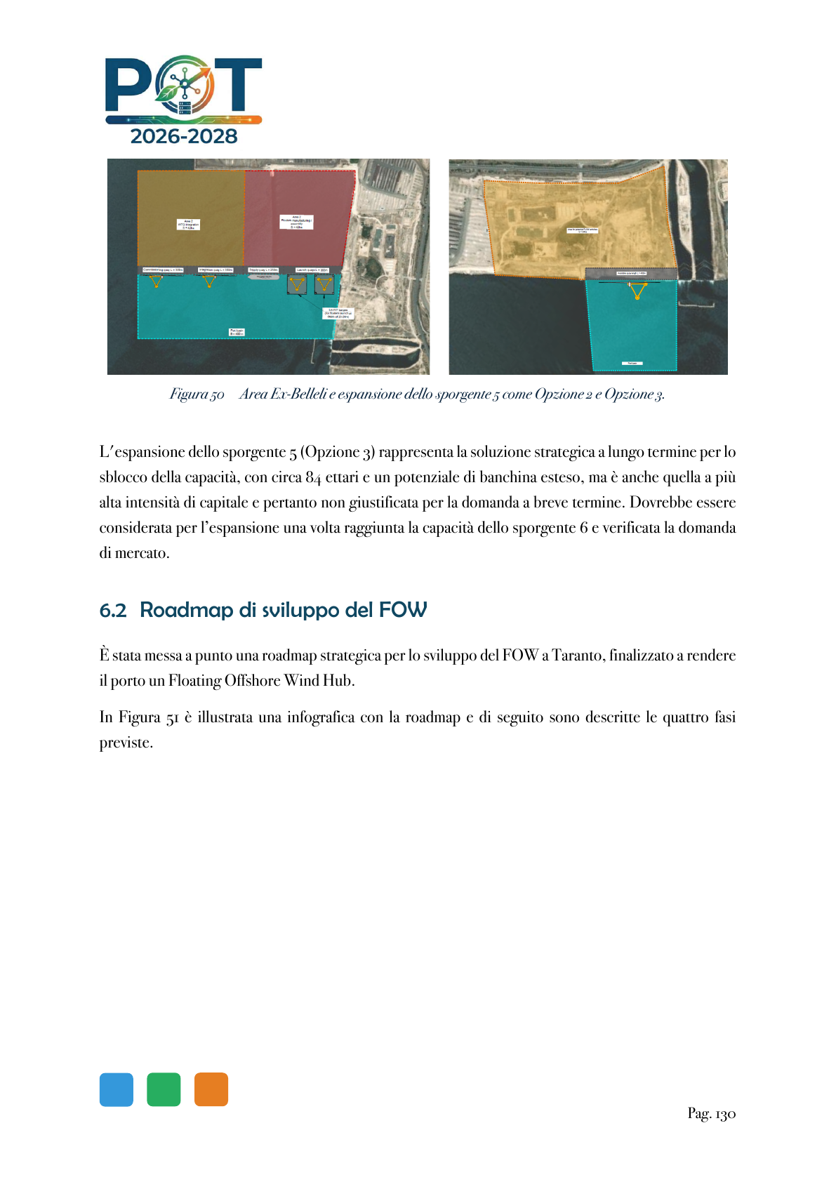
| 2 Ex Belleli | 400 m | 34 ha | 30 floaters/year; WTG integration not feasible within the POT framework | SUPPORT / OVERFLOW — verify remediation, dredging and strengthening requirements. |
| 3 Sporgente 5 expansion | 1,260 m | 84 ha | 75 floaters/year; 60 with 18 ha WTG | LONG-TERM OPTION — not present-day available capacity. |
| 2/3 Ex Belleli Plus | 825 m | 64 ha | 60 floaters/year; 45 with 18 ha WTG | CONDITIONAL OPTION — combined option requiring implementation and title. |
Functional reference categories for Reverlast
| Category | PRP codes | Summary rationale | Next planning reference |
|---|---|---|---|
| POTENTIALLY COMPATIBLE | PRO-1, PRO-2, LOG, IND-pro-tra | Production, assembly, transformation and logistics functions that may align in principle with components, floaters, maintenance and support. | GIS perimeter, state-owned maritime title, works, environment, Coast Guard, network and authorisations. |
| SUPPORTING USE ONLY | SPo-1, ASe-2, selected service and intermodal areas | Services, access, light maintenance, offices, parking and intermodal functions. | Planning standards, access, title, interfaces and safety. |
| SPECIALIST / RESTRICTED | CON-1, CON-2, IND-4, PET, IND-2, INT-2, INT-4, CTE | Container, steel, petroleum, environmental or archaeological protection, network corridors or safeguarded areas. | Only through a specific procedure, resolved interface or documented variation/ATF. |
AdSP interactive reference map
The map below is the Google My Maps layer embedded by the AdSP website. It is useful for operational works and points; it does not replace PRP zoning or establish availability.